
Keep a dated note for every map layer and parcel result consulted.
Sources for Mililani Mauka Neighbors
No official source lists every person on a Mililani Mauka block. Public records answer narrower questions. A parcel viewer establishes which lots touch. An assessment card names the tax owner. A recorded deed identifies parties to an instrument, and a survey plan fixes legal map context. Neighborhood Board and association material explains the civic area without becoming a household roster.
| Source | What It Shows About a Block | Access |
|---|---|---|
| HoLIS Parcels & Zoning app | Address points, parcel edges, TMKs, streets, zoning, board and flood layers | Free web map |
| Honolulu RPAD | Owner role, site and mailing addresses, assessment and building facts | Free online search |
| DAGS survey map index | File plans, registered maps, Land Court maps, and plat identifiers | Free index |
| Bureau of Conveyances | Recorded grantor, grantee, document, TMK, and recording date | Online account or office request |
| Board #35 and MTA | Public meetings, boundaries, facilities, maps, and community issues | Public pages or direct inquiry |
Owners and occupants are not the same. RPAD may show a mailing address outside Mililani Mauka, and a deed records a legal event rather than daily presence. Community groups may know an address as part of an association area, but their public information does not expose a private member list. Use these records to learn about the block, not to claim who is inside a home.
Map Mililani Mauka Neighbor Parcels
The Honolulu Parcels & Zoning Information App accepts an address, street, TMK, or point of interest. Its layers include tax parcels, address points, street centerlines, neighborhood boards, planning areas, zoning, and flood information. Research found no dedicated buffer tool, so the correct neighbor method is manual: click, pan, and measure outward from one verified parcel.
- Enter the full street address. If it fails, try the street name alone and inspect the address-point layer.
- Open the matching parcel and record its TMK. Confirm the site shape and street frontage.
- Click each lot that shares an edge, then check parcels across the street. Record every TMK separately.
- Open each TMK in Honolulu RPAD and compare owner, site address, mailing address, assessment year, and “Map It” result.
- For a full named-street chain, continue with the Mililani Mauka street directory instead of expanding the radius without limit.
This flow is simple: address → map point → parcel → TMK → assessment card → recorded instrument. Save the map scale and access date. Online measurements are approximate, and Honolulu warns that public GIS is not a legal survey. A true boundary issue requires a recorded plan or licensed survey work.
Note: The map's FEMA flood display carries an effective date, so capture that date whenever hazard context matters to a block search.
Survey Maps Behind Mililani Mauka Blocks
The parcel picture becomes stronger when it is checked against the Hawaii DAGS Survey Map Search. That index accepts Land Court application, map, and consolidation numbers; file plan numbers; registered map numbers; HTS/HSS plat numbers; Hawaiian Home Lands plat numbers; and CSF numbers. It is a plan index, not an ownership search.
The official DAGS search screen appears below.
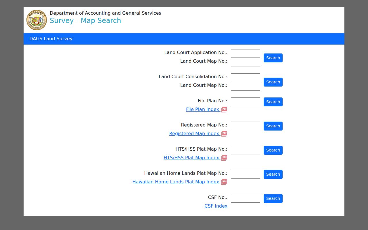
Use a map number found in a deed, subdivision record, or parcel file. The plan can clarify lot lines, easements, and subdivision labels that a general web map simplifies. If no number is known, move back to the TMK and Bureau of Conveyances trail rather than guessing.
Confirm Mililani Mauka Owner Roles
The Hawaii Bureau of Conveyances public-access route links a parcel to recorded instruments. Online coverage is generally 1976 to the present and can be searched by grantor or grantee, TMK, document number, or date. A grantor transfers an interest; a grantee receives one. Those roles do not prove that either party lives at the address.
The Bureau's public-access page shown below explains the office and written-request fallback.
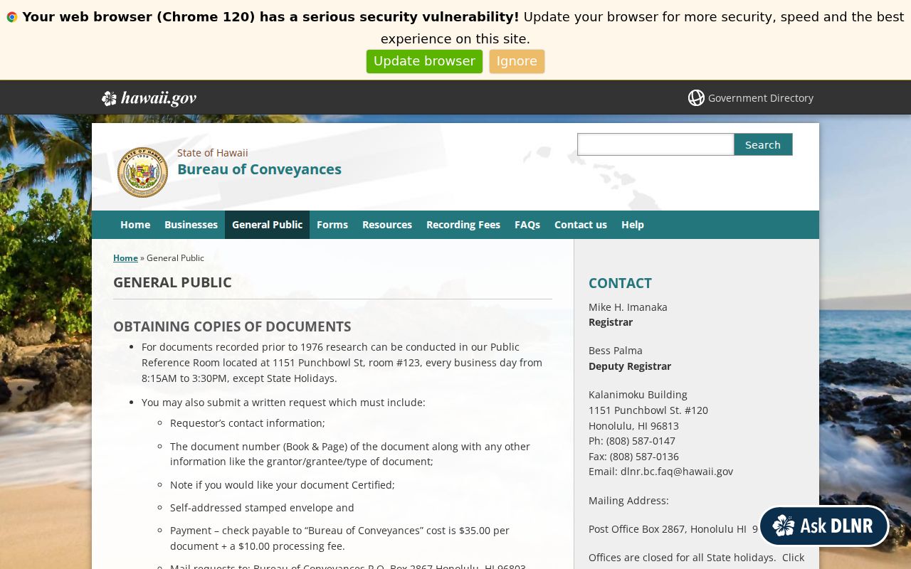
For pre-1976 instruments, use the Public Reference Room at 1151 Punchbowl Street or a written request with the document or book and page, party names, instrument type, contact details, and copy choice. The reference room, mail request, and telephone help at 808-587-0147 matter when the online index cannot return the needed record.
Compare the deed's TMK, legal description, recording date, and party role with RPAD. A recorded owner can differ from an assessed owner during a processing gap. Note both dates and ask the custodian before treating the difference as an error.
Mililani Mauka Community Neighbors
Community records add a layer that parcel files cannot provide. Mililani Mauka/Launani Valley Neighborhood Board #35 publishes meeting pages, agendas, minutes, testimony routes, and boundary information. The board has nine members and a quorum of five. Its records can place a street issue in civic time, but public testimony or a board role should never be treated as a complete resident list.
Neighborhood Board #35
Official agendas, minutes, meeting notices, testimony, and boundary records. Public meeting material is browsed through Honolulu's event and archive pages.
Mililani Town Association
Public maps, homeowner packets, facility details, forms, and association help. Office: 95-303 Kaloapau Street, 808-623-7300, weekdays 8:00 to 4:30.
Mililani Public Library
Public computers, Wi-Fi, newspapers, copying, and reference help at 95-450 Makaimoimo Street. Call 808-627-7470 for current hours and research routing.
MTA's assistance form asks for an association name, account number, unit address, name, email, phone, and issue type. It is a member-service channel, not an open neighbor directory. Ask only for public map, rule, facility, or association information. Never ask staff to disclose a private member roster.
Anchors for Mililani Mauka Neighbors
MTA Recreation Centers 5, 6, and 7 provide useful public anchors within Mauka. They sit on Ainamakua Drive, Konaku Street, and Lehiwa Drive. These places help orient a map and match a community source to the right part of Mililani Mauka. They do not identify nearby households.
Neighborhood Board meetings use Mililani Mauka Elementary as a public civic anchor. Address spelling can vary between Mākaʻikaʻi and Makaikai in government text, URLs, scans, and OCR. Search both forms, preserve the source spelling, and note any normalization. This insider step prevents a false “no result” when minutes or address layers omit diacritics.
Mililani Mauka, Mililani Mauka/Launani Valley, and census tract labels describe different boundary systems. The CDP serves statistical reporting. The board boundary serves civic participation. Association maps serve community administration. Do not force them into one outline when comparing neighbors across a border.
Mililani Mauka Emergency Access
Infrastructure records can explain why a block connects the way it does. A 2005 Senate resolution called for alternate ingress and egress study. A later Hawaii Department of Transportation announcement describes a completed gated gravel emergency road to the H-2 northbound on-ramp in June 2026.
The state announcement is captured below.
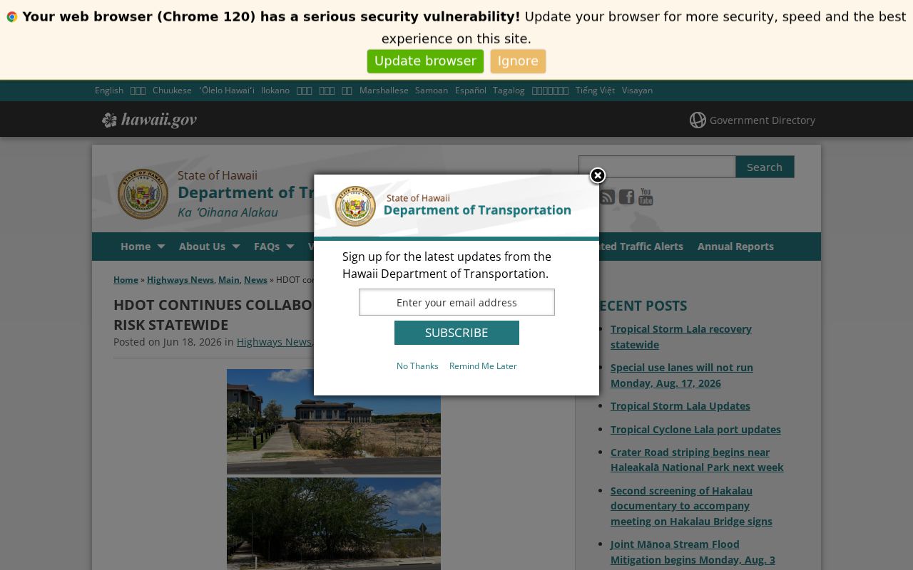
This public-safety trail is useful for understanding route planning and neighborhood concerns without exposing private people. Search board minutes and public agency records by ingress, egress, emergency access, wildfire, H-2, Kipapa, Waikalaua, and gate to build a dated civic history.
Mililani Mauka Neighbor Tools Compared
Official records are narrower than commercial neighbor tools, but their limits are visible. The map custodian names the layer, the assessor dates the tax year, and the recorder supplies an instrument number. Commercial products may merge addresses and names without showing when a field changed or which public role produced it.
| Question | Official block records | Commercial category |
|---|---|---|
| Where did the fact come from? | Named city, state, or association source | Source chain may be unclear |
| What does the name mean? | Owner, deed party, applicant, or civic role | Role may be merged or unlabeled |
| Can it be corrected? | Contact the record custodian | Separate opt-out or dispute route |
| Does it prove occupancy? | No, unless the source directly says so | No, even if presented as current |
For Mililani Mauka neighbors, source and role are more valuable than a long list of names. Keep the parcel owner, mailing address, deed party, and community contact as separate facts. If a source conflicts, date both results and seek the underlying record.
Privacy for Mililani Mauka Neighbors
Parcel and assessment records do not disclose every occupant. Renters, children, guests, and other household members may never appear in an ownership index. Utility, delivery, and private association-member details are not public neighbor data. Hawaii voter registration lookup is a self-service tool requiring the registrant's identifiers, not a block search by name or address.
Hawaii's Address Confidentiality Program provides eligible survivors with a substitute address and mail forwarding. Court seals, UIPA exemptions, vital-record rules, protected voter procedures, and agency redaction may also remove personal facts. A hidden address is a safety measure, not a gap to defeat through another source.
A neighbor search is reasonable for learning parcel context, understanding a civic issue, reconnecting through public channels, or checking a seller's stated ownership. It cannot prove friendship, family ties, conduct, or daily presence from proximity alone. Ask a custodian to correct an official error, and do not publish a private roster assembled from scattered records.
Lawful use. Use Mililani Mauka neighbor records for lawful personal and civic purposes. Never use them to watch, harass, threaten, or expose anyone.